Instagram Is Dropping Its Photo Maps Feature
Facebook-owned photo sharing giant, Instagram announced on Wednesday that it is killing off its Photo Map feature.
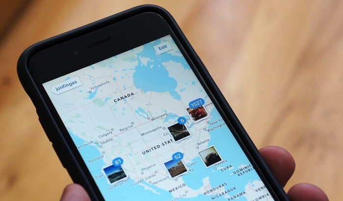
The feature allows users to browse a map that displays the locations of where their photos or another user’s photo was taken.
You could also zoom in on maps to get a closer view of where photos were taken in a particular city or region.
Advertisement
“Photo Map was not widely used, so we’ve decided to remove the feature and focus on other priorities,” the company said in a statement to Mashable.
The feature has already begun being disabled for some users last week, with the final phase coming to all in the coming weeks.
Although users can see their own photo maps but that might also change in the coming weeks. However, Geo-tags are not going anywhere. “You will still be able to see location tags on individual posts,” Instagram said.
This move is in line with Instagram’s recent attempts to move away from location based apps such as Foursquare and more towards apps such as Snapchat.
Advertisement
A few weeks ago, the Facebook-owned app also debuted a new feature called Stories, operating similar to Snapchat’s feature with the same name. Like Snapchat’s Stories, the Instagram version allows users to collect a number of individual photos and videos into a “story” that they can share with their followers.
Earlier this year, Instagram added a new feature that gave users the option to make pictures and videos disappear automatically after 24 hours. Snapchat, which has more 100 million users, is known for automatically making postings disappear after 24 hours.
Just last week, the company added the pinch and zoom feature, users can use the pinch and zoom gesture on their iPhone screen to zoom on photos and videos in the main feed, on other user’s profiles, and in the explore tab of the app.
