LOKOJA FLOOD: ‘Water Level May Take More Days’ — FRSC Advises Motorist To Take Alternative Route
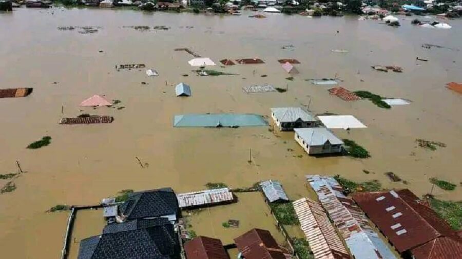
Following the flooding that submerged Kortonkarfi in Lokoja, Kogi State, the Federal Road Safety Corps, FRSC, has advised motorists plying the road to take an alternative route.
A statement issued on Friday by Bisi Kazeem, the Corps Public Education Officer, said the current flooding on the Lokoja-Abuja expressway has impeded the free flow of traffic.
The agency advised motorists traveling to the South-West region of the country through Lokoja to take the Suleja-Bida-Mokwa road.
The statement read, “This is to inform the general public, that owing to the flooding around Kortonkarfi in Lokoja, Kogi State, which has impeded the free flow of traffic on the Lokoja-Abuja Expressway for the last three days.
“Motorists traveling to the South-West region of the country through Lokoja are kindly advised to take the Suleja-Bida-Mokwa road, while those traveling to the South-South/South-East regions through the same town are also advised to go through Nasarawa-Oweto Bridge-Adoka-Otupka axis.”
Kazeem also stated that “the water level may take another two or more days to subside.”
Advertisement
The flooding which has lasted for over a week followed persistent rainfall and the release of water from the Ladgo dam in Cameroon, causing the river Niger and Benue to overflow.
However, Lokoja sits at the confluence of the Niger and Benue rivers, as residents have resulted to using canoes as means of transportation in the area.